Showing posts with label motorcycle. Show all posts

Tuesday, September 14, 2010

The Return Trip

Cook Inlet

It has been three weeks since my return from Alaska and I still haven't completed my account of the return trip; and so, belated as it is, here goes.

The return trip from Seward, Alaska back to Michigan was (as I said before) not the way I like to travel; but - "A bad day of traveling on a motorcycle is still better than a good day at the office!"

The weather throughout Alaska continued to be mostly overcast with intermittent light rain.  Just enough to require rain gear (rain gear that actually felt good in the high 50 degree temperatures).

The dim side of my headlight had burned out, making it necessary to stop at one of only two Harley Davidson dealerships in all of Alaska, "House of Harley-Davidson and Buell," in Anchorage (and of course I couldn't leave there without buying a long sleeve T-shirt).

Even though the weather was still not very obliging, it didn't stop me from making one final attempt to capture the rugged beauty of the Cook Inlet.

House of Harley-Davidson and Buell in Anchorage
It was hard to motorcycle past the Matanuska Glacier without stopping and to walk on the surface of the massive glacier (the Matanuska is one, perhaps the only one, of the glaciers which one can freely walk on the surface of the glacier without fear of being punished for doing so).  I knew, however, that if I continued to stop at every site along the way the trip would be extended for days; instead, I opted for a couple of photos and somewhat begrudgingly continued on my way.

I had hoped to travel from Tok, Alaska northwest along the Taylor Highway to the "Top of the World Highway" (the same Top of the World Highway that I had missed back in March, when the MichCanSka snowmobile riders trekked to Tok).  It was no longer a reasonable option.  Record rains had raised havoc and now the Taylor Highway was only open for twice a day trips led by a "pace vehicle" which guided a caravan of vehicles along the one-way road.  Once again, given my sense of urgency, I didn't have time for that kind of slow travel and therefore chose to repeat my previous route of travel through Beaver Creek, Yukon Territory.

Four days after leaving Seward I arrived in Watson Lake and was surprised to hear people complaining about the heat. I, of course, was aware of the warmer temperatures, but was surprised to discover that the temperature had in fact risen to 90 degrees Fahrenheit; for me it was PERFECT!

For the first time since leaving New Orleans back in April (some 17,000 miles ago) my motorcycle was a "concern".  It was mysteriously shutting down on me for no apparent reason.  Thus far, each time the engine had quit it restarted without incident - but, what if it suddenly chose another option and stranded me in the middle of nowhere?

Matanuska Glacier
The motorcycle problem had first started in Watson Lake, but it was still a concern as I rode, now miles to the south, in Fort Saint John British Columbia.  Clearly, it had to be checked out.  

Safely making my way to Grande Prairie (where I had been advised that there was a thriving Harley-Davidson dealership), I was greeted "royally"; stopped adjacent to a busy Grande Prairie intersection by the Grande Prairie Police.  After thousands of road miles without incident, I was pulled over because my license plate was hidden by my "luggage".

I advised the officer that I had traveled through 26 states and 5 territories and that - "This was the first time I had been stopped."  He, of course, could hardly care less, and most likely considered that fact a compliment; but, fortunately he let me go and only advised that when I load my gear on tomorrow - "find a way to strap your things in place in such a way that will allow your license plate to be visible."


I appreciated being given a break, but nonetheless can't help thinking that he knew that his advise would be shamefully ignored; after all, it had not been a problem for all these miles, and it was not a safety hazard.


The Harley dealership in Grande Prairie disposed me of $190 and advised me that there was a computer related electrical problem that was advising the onboard computer system that the engine was overheating and therefore needed to shut down.  I was told that it was likely a loose or abraded wire that was causing the problem, but the "guilty" wire could not in fact be found without further research and (obviously) further dollars.

I decided to put wallet back in my pocket and depart - POST HASTE!

Friday, July 23, 2010

Haines Alaska

Ferry From Skagway to Haines

Everything worked as hoped; it was indeed possible to take the ferry by motorcycle and go either to Juneau or Haines, Alaska.  Juneau (while it would be nice to see the capital city) would still leave me landlocked; there are no roads in or out of Juneau.

At the rate of $100 each way, Juneau was never a viable option, and in the morning I left for Haines.

The ferry ride was somewhat disappointing, the anticipated souring glaciers were no where to be seen.

In contrast, Haines is a beautiful city; or more accurately, it is a beautiful setting.

Looking across the bay my eyes were drawn to the site of the large homes that adorned the mountainside.  As picturesque as the view was, however, the clouds so thoroughly obscured the mountains that, it was not until later when I saw that very image displayed frequently around Haines and on brochures promoting the area, when I fully realized I was missing much of what must be a truly breathtaking sight - the souring mountain peaks, as a backdrop to Fort Seward, that make the image a favorite of artists and photographers alike.
  
I did not realize at the time that I looking at the site of the military base of old Fort Seward, but I knew that the site would be my first stop.

Even though, as captivated as I was by the sight of the large homes across the bay of open water
I would never see that entire image in its full glory.  Unrelenting, the clouds never broke.

Today the large buildings that once served as officer quarters, administrative headquarters, medical centers and the like, have now been converted into hotels and condominiums.  Further below them and across the old parade and exercise field stands the one remaining (of the original two) huge 2 1/2 story barracks building.  Too costly to repair, it stands as a sadly decaying hulk.

The setting was perfect, my campsite was owned by the Halsingland Hotel (one of the hotels converted from the old officers quarters); and was low priced, had WiFi, showers, laundry and a bar/restaurant - all of the amenities of home!

Smaller and lacking the hoards of tourists that highlight Skagway, the main claim to fame for Haines is the Chilkat Bald Eagle Preserve; the site of the largest collection of bald eagles in the world.

Fort Seward From Across the Bay
Unfortunately the season for seeing eagles in mass is during the months of October and November.  I was told there are thousands of the big birds at that time who are not only prominently visible, but easily approachable to within a few feet.  The reason is that during this time, the eagles in committed feeding frenzy; basically the "lid is off the cookie jar" in the form of dying salmon which are gobbled up by the eagles.

The next day, having completed my tour of Fort Seward, I rode out to Chilkat State Park hoping to catch sight of the black bears (a mother and two cubs) that had been reported to be in the area.

The fishermen were already wading the in the waters of the Chilkat River (hoping the hook one of the early salmons just beginning their annual run up the river); but no bears were seen.  I would have to wait until two days later (when on the ride from Haines to Haines Junction, British Columbia) to catch sight a seemingly friendly bear, caught idly munching at the roadside.

Almost too "seemingly friendly;" unconcerned by my attention, the temptation was to slowly approach closer to get a better photograph.  I had to caution myself, remembering that "this after all a wild black bear" that if threatened by my advance would perhaps - Well, I just didn't push it!

The  Barracks at Ford Seward
However, I'm getting ahead of myself.  After returning from the state park, I went over to the hotel to address their WiFi.  While there working on my computer, I met the congenial Elize Winby Wall who was also working on here computer.
                
We conversed and I learned that she was a casualty of computer downsizing, we discussed are seemingly similar situations - both of us retired, but neither if us by choice!

She said that it was the best thing that ever happened to her; she would have otherwise never started traveling and fully enjoying life - in her words, "I'm having a ball!"

Halsingland Hotel (on  right)
A licensed pilot, who has her own plane, she informed me that her husband (also a licensed pilot) was killed in an aviation accident, and that she had only recently returned to flying herself.

Starting anew - along with her companion, a dentist (and pilot - of course!), have more freedom than most to enjoy life's many wonders; and they seem to be doing quite well - thank you!

Another commonality, Elize is also a bloggers (www.dogfishstudio.com); the people you meet on the road are often the hi-light of traveling.

Monday, July 19, 2010

Alaska and Back Again


The road out of Alaska and back in again, would take me from Stewart, British Columbia (Hyder, Alaska) to Watson Lake, a long ten hour ride.  The road is paved all the way except for a few minor stretches of gravel road along the way (the longest run of gravel is less than 5 miles long).


The gas stops are few and far between; it's no problem, one just needs to be sure to leave with a full tank of gas and not pass up any gas stations in-between.  It's a nice drive, but only moderately scenic (remember, - everything is relative).

My choice (and my recommendation for a campground) in Watson Lake is the Downtown RV Park.  It is conveniently located (as the name suggests) "downtown" and is within walking distance of most everything there is in Watson Lake.  

There is not a lot to see or do in Watson Lake, when we passed through there in March on the snowmobile trip (see the older blog dated March 4, 2010) I failed to get a picture to the famous Watson Lake Sign Forest; therefore I was intent on correcting that error and also looking through the "forest" in effort if there was a sign from close to home.  The "winner" was Jonesville, Michigan (see photo).


The Northern Lights Centre is another Watson Lake attraction that is quite interesting and in my opinion well worth the minimal cost.  Even if one chooses not to see the movie, it cost nothing to tour the small but interesting facility. 

Originally my thought was to go from Watson Lake west to Whitehorse and then north to Dawson City; but, once again, that was the same route I had traveled in March - Why repeat it? 

As it turned out it was a not moot question; torrential rains in Alaska (on a scale that had not been seen in this area in decades) caused flooding which washed out vast sections of highway throughout a purported 100 miles.  The highway is closed until repairs can be completed (an estimated 6 weeks working around the clock - providing that the weather cooperates).

With that one option eliminated another one was interjected - by missing the turn to Whitehorse and continuing straight to Carcross, I could turn south and go to Skagway (the second most, after Hyder, southerly point of entry into Alaska).

 It was an intriguing option, traveling (for me) an uncharted path, even though it would necessitate backtracking back to Carcross in order to continue north through Alaska.  There are no Alaskan roads leading north out of Skagway, the only option was to return via Carcross; unless, it was possible to take my motorcycle by ferry to Haines, Alaska (an even more intriguing option!)


It was a plan I could (and did) get excited about, the decision was made - off to Skagway.

Skagway was the starting point for the White Pass route to the Klondike during the gold rush; a historic town that was bound to be loaded with things of interest.

The only problem getting to Skagway before dark; with so much spectacular beauty to contend with, it all seemed magnificent to ride by with my camera packed away in my saddle bag (I couldn't do it!)  In the end, it was only darkness that made me pack the camera back in the saddlebag. 

Skagway (according to the 2000 census) has a year around population of 862 residents, but it's a volatile population that doubles over the summer tourist season in order to cope with boat loads of tourists that unload from 2-3 huge cruise ships almost daily, the White Pass Railway and a number of tour busses.

In appearance Skagway reminds me of Dawson City, Yukon Territory; but, despite the fact that Dawson City has more than half again the year around population, Skagway appears much larger.  The reason, Skagway has 900,000 annual tourists (15 times more than that of Dawson City's mere 60,000) that encourage more support services.  

With the volume of tourists flocking downtown, the streets are a swarm of activity up until 8:00 PM when the cruise ships depart and all of the numerous tour buses have long since departed; after the 8:00 o'clock hour, one could "drive a dragster" down main street without fear of striking a single sole!


Wednesday, July 7, 2010

Montana and on to Canada

With a late departure from Craters of the Moon Nation Monument the next stop was at an RV Park in Mackay, Idaho.

It had seemed like (when passing through) that "-Utah has more horses than any other state."  It is not true, of course, but from my perspective, through the chosen route of travel, and on a motorcycle - that was my honest perception.

Now, in Idaho there seemed to be little difference (at first).  In Pocatello, local fairgrounds had been preparing for a horseshow, and horses were everywhere.

Nonetheless, as much as the Idahoan's still love their horses the four-wheeler seems to be "taking over" and are the current vogue and now - "they" are everywhere!  The RV Parks are filled with trailers loaded with four-wheelers, they run streets (and even the highways, in smaller towns), are parked at restaurants and (shudder) the bars.

Mackay is small town on highway 93 that seems to caters to four-wheeler's in a big way, and is a prime example of a town taken over by four-wheeler's.  The hillsides leading to 10,000 foot snowcapped peaks are apparently all the invitation that is needed.

Years ago when traveling through Idaho, I remember seeing scores of potato "barns;" but on this trip they seemed surprisingly lacking (was it due to new technology or was it just this area of Idaho?)

Mackay is only about 252 miles from Missoula, Montana, but with stops along way I knew that it was likely to be a two days motorcycle ride - and it was.  The day ended at Hamilton, Montana a mere 40 miles south of Missoula, but since it was a sizeable town with internet cafes and a visible RV park, Hamilton it would be!

Since leaving Utah, it had been a steady progression, a sort of "Greening of America;" and now, in Montana it was as if it had come to full strength.  Take away the mountains, and my thoughts even drifted to Michigan; but not for long, the only similarity is the color green!

Things were piling up, there had been no time breaks between stops, no time to blog, no time to address those nagging prevailing issues we all have and not even time for laundry; and so, it was two days later before gear was loaded on the motorcycle for Kalispell, Montana.

Kalispell was only 167 miles from Hamilton, but it was near the entry to Glacier National Park and therefore a perfect stopping point.

For some unknown reason (perhaps, it was because as a young man I had romanticized visions of going to smoke jumpers school and then working during summer breaks from college) Missoula held an attraction for me, and it was hard to just pass through without stopping; but there was no real reason to stop after only 40 miles, and so it was on to Kalispell.

Kalispell is, as an acquaintance turned friend, described, "is a great place to live and great place to retire;" strange words coming from an unemployed 42 year old man, but as an ex-patriot from Iowa he obviously was infatuated with Kalispell.

With my short time there and my limited exploration, it is hard to pass judgment, but for the sportsman, hunting and fishing abound and it is beautiful country.

My time there was extended as I still endeavored to bring things back together, and as the weather provided three days of on-again, off-again rain.  The mail from Michigan had finally caught up with me and, for the time being, those nagging personal issues had been taken care; and so, despite the weather, it was now time to go!"

And so, with some hesitation (the hope was for clear skies sunshine while riding through Glacier National Park) I loaded the motorcycle and departed from Kalispell to drive through Glacier National Park.

Actually, in spite of the forecast the overcast skies were rather pleasant despite the cool air.  It seemed good to be back on the road after having spent several days in Kalispell.

The road from West Glacier to Marysville (the east side entry to Glacier National Park) travels over Logan's Pass by way of "the Road to the Sun," and winds its way past Lake McDonald and the often times raging whitewater of the Flathead River before reaching the highway's summit at the Logan Pass Visitors Center.

The rain held off for most of the way, and provided some views, but it was hard not to wonder what clear skies and sunshine might have provided.  Sometimes the cloudy skies provide spectacular photos, but it seemed for the most part that such was not to be.

The rain increased as I approached Logan Pass; my finger tips seemed as though they were about to freeze as my gloves were now soaked with rain.  Until then, the rain had been only fleeting, and still it was only a drizzle; but at nearly 9000 feet of elevation, and with air cooled to (an estimated 40 degrees) it was a "bit" of a chilly motorcycle ride!

Even with the rain I could see that Logan's Pass was a spectacular view, but with the rain and cold I bore on without stopping, and arrived at St. Mary's (the eastern entry to Glacier) about 5:30 PM.

With no campgrounds in sight (it was too early to end the day anyway), and hoping to make it well into Canada before nightfall, I continued on.

Given my past record (and knowing that the gas stations are often hard to find in Canada) I made sure that the tank was filled before leaving for Canada.  There was a third reason; of course, the gases prices in Canada can hurt you!

Entering into Alberta from this point, was crossing into unknown territory and I was somewhat surprised by the distances between cities.  When I stopped for the night at Fort MacLeod (a distance of approximately 50 miles) only two cities had been passed.

Thursday, June 17, 2010

The Four Corners - Land of the First Americans

It was time to move again and I actually had a plan - westward toward Farmington (in the Four Corners region of New Mexico, Colorado, Utah and Arizona) to explore the Aztec ruins as was the original intent before the Cumbres & Toltec Railroad intervened.  From there the plan was head north to Durango and Cortez, Colorado and on to the Mesa Verde and Hovenweep Ruins, before returning back to New Mexico to find a campground around Farmington.

The Puebloan's, of course, knew no borders and Hovenweep itself extends for miles into and around Blanding, Utah which is (because it is in Utah and not Colorado) considered to be a separate ruin.  I knew that this area would be less explored and might therefore offer more interest; but then, it was likely to be gravel roads and much less motorcycle friendly and was, therefore, left off the planned agenda.

Even by choosing the Four Corners region and drawing "a line in the sand," I still crossed the line.

Chaco Culture National Historical Park is less than 80 miles south of Farmington, and too much of allure to resist.

There are literally hundreds of archaeological ruins left by the first Americans; a large number of which blanket the southwest.  With so many ruins available to see throughout New Mexico, Colorado and Arizona (in particular) and to a lesser extent Utah, it was once again difficult to choose a route of travel to see as much as possible without - making a career of it!  The Chaco Culture would be just one last stop before turning west for Arizona.

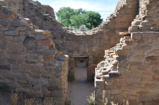
In the of course of asking questions about The Aztec Ruins, someone mentioned that, "There was not that much to see at the Aztec Ruins National Monument;" and so, when at last I found myself standing within the compound of the ruins gazing over hundreds (450) of pueblo rooms, I was awe struck!  Not much to see?  What had he been looking at?

What we see today is not as it was in the period of its occupation.  The rooms were two and even three stories high in places, but how far did the multi-stories extend (no one knows for sure).  Then too, the original walls were covered smooth with a stucco-like parging and it's believed that they once walked across the roofs of the Kivas.  Unlike the Maya and (presumably) the Aztecs of Mexico they used a mortar like base to bond the stone work together.

Round Kiva's or ceremonial centers abound throughout the complex the largest of which is a Kiva reconstructed by early archaeologist working at the site.

This huge Kiva perhaps create more questions than it answers; its diametric size is without question but height of its walls and the number of stories of the are questions, the answers to which are forever lost in time.  

As impressive as the ruins are there is an entire set of east ruins (said to be approximately equal in size, remain yet to be excavated and are therefore closed to visitors.

Of course, the site is not an Aztec site at all.  It was given that unfortunate misnomer by the great South American explorer Alexander Von Humboldt, who mistook it to be related to its distant neighbors to the south.  Given the time frame and how little was then known about early American ruins, his error is easy to understand.

It was a relatively short ride from Aztec to Durango; and when I rode into the town, I peered through the trees from highway that overlooks the city below.  My first thought, given my brief glances, was that I was overlooking an open pit mine of some sort (I still don't know where that thought was coming from); nonetheless, however wrong, it was my first impression from my brief, but inspiring overlook (see the sloping roadway).

Durango is a college town with a very collegiate (or even Yuppie) atmosphere.  In a strange way it had, for me, the look and feel of mini (very mini) Austin, Texas.    

My stay in Durango, which only intended to be an overnight at the nearest campground, did not go well.

The site of the Durango & Silverton Narrow Gauge Railroad (ala, the Cumbres & Toltec Train - Chama, New Mexico) Durango is a popular tourist destination; and as such, an expensive place to stay.

Surprisingly, given the tourism, I had a hard time even finding a campground and when I did it was (not surprisingly) a quite expensive $28 a night for just a primitive tent site.

Before leaving Durango, I decided it would be good to replace one of my aging Harley T-shirts with a new Durango Harley Davidson T-shirt.

While there, I made another decision to have my Harley checked out.  A day and a half later, and after having relieved myself of $900 dollars, I left Durango with "fond memories;" I knew that my tires were getting bad, but the brakes (which were in worse shape than the tires) surprised me.

The truly unfortunate thing about my brief visit to the Durango Harley Davidson, was that, the one thing that I wanted have checked out, did not get checked.  They told me that the repair parts (if needed) were on backorder, and as a result they recommended not doing the check out.          

Tuesday, January 5, 2010

Men in Blue

With things to tend too, it was after 4: OO PM before I left Naples. With the late departure I was already having doubts about finding a campground before dark, but I knew it was time to get out of Naples. The $58 per night for a tent site with no electric was blowing my budget. After 30 days on the road things were getting tight.

Traveling on I-75, in an effort to north as far and as fast possible, I spied a sign for a State Park. To my disappointment the State Park, was a beach and not a campground at all. No camping permitted.

The park ranger advised me that there was another State Park just to the north where they had campsites. He called ahead to see if any campsites were available. Campsites were available, but the campground would close at sunset which was only 20 minutes away. The ranger (still on the phone) advised them that I was on a motorcycle and should be able to make it within the 20 minute time frame. He was wrong; and to my misfortune they didn't - "leave the lights on for me" - or the gate open either. I hadn't timed the trip, but it seemed like less than 20 minutes. No matter - the gate was, still CLOSED.

Sitting, despondently, in front of the gate, I thought back to when (in Pennsylvania) I had pitched my tent outside of a "roadhouse" restaurant and, more less, gotten away my pursuit without any difficulty.

Looking around, there was plenty of area where I could pitch my tent and probably, ...possibly, ...perhaps, ...maybe, not be noticed; but, where would I put the motorcycle? The ground was questionable soft, and even if it were not, I would be in real trouble if caught riding on the grass in the State Park (even I, thought that this would be worthy of punishment).

I returned the highway to consider my options.

While gassing up, I sighted a car wash separated from the gas station by a wide driveway. Investigating, it looked perfect. I could pitch my tent out of site behind the car wash, and park my motorcycle nearby (out of sight of most anyone). Wrong again!

About 3: 30 AM, while resting soundly, I was alerted by the sound voices and "flashlights'" approaching my tent.

"Is there anyone in there," asked one of my unwanted guests.

"Yes," I replied.

"Who's with you?"

"I'm alone"

"Come out here."

"I've got to get my pants on."

Brief pause, "Do you have any guns?"

"No," I replied.

"Hurry up."

I'm putting my pants on."

"Come on, you're not going to a prom"

Out side the tent now, they (four males and a female officer) continue, "Where are you from"

"I'm from Michigan," I replied,

"What are you doing down here?"

"I'm just traveling around the country and writing a blog as I go."

"Probably robbing banks," replied, "my nemesis", sarcastically.

"Sit down," ordered someone else.

Looking at the dew soaked ground, I hesitated.

"Sit down now!" he barked unkindly.

Sitting on the dew soaked grass, one of them felt my pockets and asked, "What's this?"

Not waiting for my reply, he shouted, "Do you have any knives?"

"I don't any weapons," I replied.

To which "my nemesis," obviously impressed with himself, interjected (a comment which he would repeat, to my utter contempt, several times) "he's just here robbing banks."

In the end, despite "my nemesis," urging, they must have determined that I was neither a bank robber nor "Jack-the-Ripper." After "my nemesis" offered one final admonishment, "just keep from robbing banks, and you'll be alright," they allowed me finish what was - a restless sleep at best.

I awoke later, thinking to myself, "They were just doing their job;" but, I hadn't really done anything to be ashamed of - so why was I feeling so ashamed? "If your going to act like a vagrant, you've got to be able to roll with the punches," I told myself.

However, "I am not a vagrant", and I'm not sure that I am up to the task.

All of the officers, save one, had treated me with respect; which, in my opinion, was our mutual responsibility (and was greatly appreciated from my perspective). "My nemesis," on the other hand (in my humble opinion), brings shame to uniform.