 |
| Too Close! |
Boatelo (a local watering hole) where a patron had advised me that only 58 miles from Fairbanks, on
the road to Chena Hot Spring, "...you're likely to see moose and possibly even a bear."
Taking him on his word, I rode the 58 miles and found that his advice was sound. On the way I
indeed saw two moose and was able to get close enough for a good photo (probably, once I was again
 |
| Thankfully - On the Opposite Bank |
four quick shots of the large cow; she looked directly at me (seemingly undisturbed by my
presence).
Apparently, such was not the case; as I turned to walk away, I suddenly was alarmed by the sound of
rustling water, as if an entire bathtub of water had suddenly been dumped into the creek. Turning
back around, already fearing that I was being pursued by the huge animal, I was relieved to find
her already standing on the opposite bank with water streaming from her body. I knew immediately
that I had gotten "way too close". If the beast (and a moose is indeed a beast) had decided that I
was somehow a threat, and had came my way instead of towards the opposite bank - I could never have
escaped.

Days later I was told that moose kill or injure more people than bears; mostly due to the fact that
tourists seeking to capture a photograph have less fear of a moose than a bear and approach (as I
had done) - way too close!
My reason for going to Chena Hot Springs was simply in hopes of seeing wildlife and having succeeded I had no interest in swimming in the hot springs or continuing my stay and therefore departed.
From Fairbanks to the Yukon River bridge is a distance of on hundred and thirty miles, and my side
venture to Chena Hot Springs had assured me that I could not make it that far before the late in
the evening (not that it mattered - it would still likely be daylight, whatever the time.)
 |
| Pipeline Going Underground |
Having loss more time and still wanting to put some distance between my final stop for the night
and Fairbanks, I continued north. The hope was to at least make it off the Elliot Highway (itself
a picturesque ride along a winding roadway with roller coaster mountainous terrain) and onto the
Dalton Highway. If only for purely symbolic reasons, it marked (for me at least) the start of the
trek to Prudhoe Bay.
 Motorcycling north ever mindful of that schedule that didn't exist (old habits die hard) I couldn't
resist stopping to photograph the wondrous beauty. At times the mountains take on a surrealistic
quality - looking more like a painting than an actual photograph. I found myself repeatedly
examining the results of my efforts; only to confess in the end, "Yep, that's what it looks like!"
Although I had still not made it to the Dalton Highway and it was (of course) still daylight, I
pulled off the Elliot Highway. The Dalton Highway would have to wait until tomorrow. What the
sign had indicated to be a campground was in truth nothing more than a pull-off - in any case, it
was home for the night.
In the morning, hungry and un-cleansed, I continued north for Coldfoot - today's destination.
It wasn't long before the Elliot reached the Dalton Highway; a bit of misnomer by normal standards,
but this is Alaska and the Dalton is indeed a "highway," albeit gravel (or mud) in many parts.
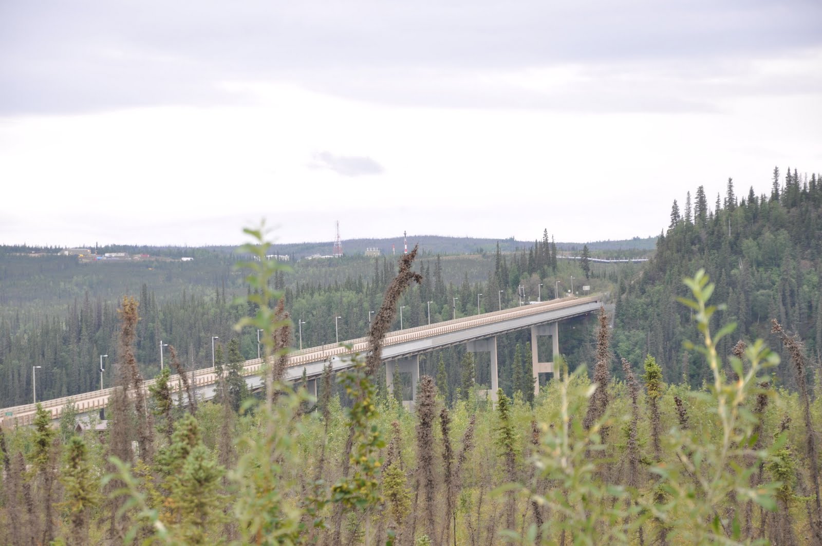 |
| Yukon River Bridge |
North America, and the only gas stop between the Road House (16 miles north of Fairbanks) and
Coldfoot.
Impressive as the bridge is, it was impossible not to question - "how it was not a formidable
problem to cross the wood beamed roadway when it was heavily laden with winter snow." Even with
sand on the roadway or chains on the tires, it's hard not to wonder just how well it works.
 |
| Surreal Photo |
Between the Yukon River Bridge and Coldfoot lie two major points of interest - the Arctic Circle
and Finger Mountain.
The first one - Arctic Circle - marks the northern most point of the summer solstice and the
southern most point of the winter solstice. In other words, it is that line of latitude at which,
 |
| Finger Mountain |
sets, and during the northern winter solstice (December 21) "at least" one day of total darkness.

Finger Mountain, the second major point of interest is not much of a mountain at all, little more
than a hill to the normal eye, but it is an anomaly to the region; formed from lava outcroppings
300 million years ago when rock pushed though the earths crust and changed the landscape forever -
it is a unique feature of the artic tundra and stands out, "like a sore - FINGER!"
No comments:
Post a Comment