Friday, June 4, 2010

The Roswell Experience

From Carlsbad the logical route seemed to be to go north to Artesia and then turn west to towards Alamogordo and the White Sands National Monument; but, after a further check of the map and seeing that Roswell, New Mexico was a short 40 miles away, I couldn't pass up going there.

Roswell is the famed site of the mysterious UFO crash in 1947.  So much has been written of what happen and the (supposed - you be the judge) government cover-up that we will probably never know the truth about just what or didn't happen that June (or July - the incident was reported the federal government on the 8th of July 1947, but may have actually occurred in late June).

One thing, however, is certain - it didn't happen in Roswell.  The actual crash site about 45 miles southeast of Roswell on a ranch near Corona.  Roswell is where the Roswell Army Air Field base was located; and, hence, where the investigation was carried out.

The International UFO Museum and Research Center, is located on Main Street, and contains a number of newspaper accounts, reporting's and photographs related to the incident and, although, it is pretty much mandatory to visit the center - unless you're a true "UFO Nut" searching for every tiny tidbit of information - it is not all that interesting.  

A city of Roswell, 45,293 (2000 census) is much larger than I had supposed.  It also the location for the New Mexico Military Institute (a high school through junior college academy for aspiring cadets) and the home of Mine That Bird, the (50-1 shot) winner of the 2009 Kentucky Derby.

I spent more time in Roswell than intended; the result of mechanical difficulties in the front forks on my Harley.  The cause of the problem was another sheared off bolt (remember the saddle-bag incident?).  The photograph was just what we saw when we took off the front cover exposing the forks - had the spring also sheared, it would have meant total disaster!  
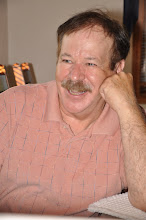
To my good fortune, Erin and Debbie McGonagle, the owners of Trailer village RV Park were I was staying, were bikers; and also to my good fortune, Erin was mechanic who collects and rebuilds antic motorcycles.

Not only do Erin and Debbie run a top-notch (with great pricing) RV Park, but they are really great people.  Erin took me (twice) to the local Harley dealer, spent half a day making the necessary repairs (with the aid of his friend Perry) and they refused to accept anything in payment for their efforts - accepting only a handshake as payment in full.

Wednesday, June 2, 2010

On to Carlsbad Caverns

Traveling in Texas, and perhaps even more so in New Mexico, its miles and miles from one place to the next.  I'm from Michigan and it's just weird!

From Study Butte, just outside of the national park, to Alpine, Texas it's 79 miles with nothing in between.

Normally it would be no problem, but just before leaving Study Butte, I discovered that one the two bolts that held my one of my saddle bags in place had sheared off.  Seeing nothing in Study Butte that resembled a garage, I attached a bungee cord to lend some support to remaining bolt, and headed north for Alpine, hoping for the best and fearing the worst.

Good fortune stayed with me and I made to a garage in Alpine where the bolt was replaced ($49 and about 30 minutes work); but I was just glad to have the bag once again held securely in place.

Back on the road and more wide open spaces; from Alpine to Van Horn, Texas is a distance of 100 miles with two towns (of sorts) in between.  By the time that I got to Van Horn I knew that I was done for the day.  Even if I could make it the entire 118 miles to Carlsbad (again, with almost nothing in between), it would mean riding my motorcyclein the dark and missing all of the scenery while passing through the Guadalupe Mountains - absolutely NOT!

Fortunately, Van Horn had a small campground; not a bad situation since it was time to do laundry anyway.

My morning ride up highway 54 to Carlsbad was pretty unspectacular until Guadalupe's El Capitan came into view.  El Capitan rises high atop the Guadalupe Mountains and offers a great view well deserving of the photo-opportunity that it presented.  I couldn't help thinking how much it reminded me of Casa Grande in Chisos Basin of Big Bend, both Case Grande and El Capitan are the focal points of their respective areas and look remarkably similar.

I was surprised to see other riders pass by and show no interest in taking advantage of such a great photograph (a mistake they would no doubt later regret).

A short distance down the road (still within the confines of the Guadalupe National Park) I took no pleasure at all (Bikers have a kinship!) in seeing the same group of four riders pulled off to the side of the road; having gained the full attention of the Texas Highway Patrol.

After making to Carlsbad, finding a campground, set up my site and have bite for lunch, there was still time enough to drive back to Carlsbad Caverns and plan routine for the next day (but not time enough to explore - that would have to wait fro another day).

What can you say about Carlsbad Caverns except that all of the hype is not overkill - they are all that they are built up to be, and more.

The caverns are, well - CAVERNOUS (see the people and handrails in the photographs to get some perspective on the size).  In terms of hanging stalactites and rising stalagmites it was all that I had anticipated, but I was not prepared to see the cathedral-like size of the various rooms, they are simply huge and seem to never end.

On the first day (of my two days spent at Carlsbad Caverns) I walked the two hour self guided sojourn with the help of the interpretive audio (well worth the $3 investment), and followed up in the afternoon with a second two hour tour (this time guided) of the Kings Palace.

This second tour was stretched out into a two hour tour, courtesy of the guide who seemed to relish expounding upon many details which already been detailed in the interpretive audio or other media presentations.  We were told that Kings Place had been previously a self guided tour, but due abusive tourist activity (such as breaking off pieces of cave "art") they were forced to abandon the self-guided tours.

One final comment regarding the photographs from inside the cave; it is impossible to get photographs using a flash (given the size of cave and the subsequent distance from the objects).  Therefore, I opted to attempt rest the camera in the handrail and use a 1 1/2 - 2 second time lapse photograph).  Consequently, the photographs suffer from some "shake", but hopefully you will agree that they are better than - no "photos" at all.    

Sunday, May 30, 2010

Big Bend - Big Beauty - No Security

From the Caverns of Sonora, it was still 142 miles to Fort Stockton plus another 58 miles to Marathon and still another 63 miles to the Big Bend National Park.  After touring the cave, I knew that the night would be spent in Marathon (with luck) and not Big Bend.

No problem, with each passing day I feel a new affinity for my developing pattern of slower paced and more relaxed travel.

Marathon is a laid-back village of less than 500 inhabitants, which probably owes its existence to the fact that it is on one of the two main highway arteries leading to Big Bend National Park.

After spending the night at the only RV Campground in Marathon, I set my course for Big Bend with no plan beyond camping in the Chisos Basin (elevation 5400 ft.) in order to attempt the avoid what I had been told would be sweltering heat.

Of course, the of Big Bend does not start at the boundary of the park, the landscape now features rising mountain vistas as it has for many miles.

While still outside the park, I saw a sign advertising Hailey Stockman's Museum; and so, I turned to see what Hailey did to earn her claim to fame.

Not a major attraction, the museum door was locked with only a small sign advising anyone interested in seeing the museum to pick up the key at gas station next door - not a high security operation.

Once inside the ranch house (turned) museum, I signed the guest register, scanned the small rooms and read a couple of the numerous newspaper clippings featuring the accolades of Hailey's life as a West Texas rancher.  Having been advised to help myself through the museum and, if interested, turn on the video on the life of Hailey Stockman, I couldn't resist.

The video was professionally done and quite interesting, but after 45 minutes (I later learned the video was 55 minutes long) I knew more about Hailey Stockman and the Stockman family than I ever cared to know - and turned it off.

From the museum, the map showed that the road continued on the banks of the Rio Grande; and so, I continued on to see what the Rio looked like.  I wanted to see how our border was secured and what ever else was awaiting me - I can't say that I was surprised.

The road ended at a bridge where passage to Mexico was blocked by a barricade topped with concertina wire, but not guarded.  Then, I remembered having passed the border patrol check point a few miles to the north on main road leading to the park (I guess, in terms of border security, it was as best as could be expected) under the circumstances.

In any case, it was clear that fording the Rio Grande was no real obstacle against entering the United States illegally.  It was a theme that I found prevalent throughout the park.  So prevalent, in fact, that at one point (unable to resist the temptation) I rolled up my pant legs and waded through the less than knee deep water to an island no more than ten feet from Mexico.

In the end, it was the fear of slipping on a rock and submerging my camera that finally deterred me from becoming an illegal alien in Mexico!

What stuck me most about Big Bend is its ever changing scenery; from the shear rock face of Casa Grande in the Chisos Basin, to the up heaved rocks that mark the volcanic active of bygone centuries of the Castolon region, to the smooth white lava flows from the same region, to the canyon walls of the Santa Elena Canyon divide between Mexico and the United States and the ever present beauty of the cacti throughout the vast desert lands.  The park is huge (covering over 800,000 acres) and I traveled the total lengths of the three paved roads coursing through the park, but there are numerous unpaved roads, which are not particularly "Harley friendly", I was forced to leave unexplored (darn, darn, darn).

Big Bend is a popular destination for bikers and my second day, I found myself riding with one Larry Russo, a New Jersey transplant now living in Florida.  Larry is a bit of a "rookie" when it comes to biking, his 2002 Harley Davidson Road King has a mere 196,000 miles and has gone through one engine and three cam shafts.  As he told me, "he bought it to ride - not to set in the garage".  Compared to him (with only 46,000 miles on my 2003 Fat Boy) I'm definitely the "rookie".

Our ride together took us to Study Butte and the Ghost Town of Terlingua (actually, both of which are located just outside of the parks boundaries).

Today Terlingua is not a total Ghost Town (if it ever was); the old Howard Perry (the owner of the Chisos Mining Company which extracted mercury from the cinnabar ore containing the mineral terlinguaite) mansion is undergoing renovation and has two rooms available and the Ghost Town Gale & Co., are both still in operation.

Friday, May 28, 2010

The Caverns of Sonora and the West Texas Hills

Heading west out of Austin, my first stop was expected to be Stockton, Texas.  From there it would be decision time, whether to go north to Carlsbad Caverns National Park and by-pass to Big Bend National Park, or add Big Bend to the itinerary - I already knew what the decision would be.

In case you're wondering, the entire Panama plan has been abandon.  Perhaps, the decision to not go there was made when the mother of my Louisiana friend (Bernie's mother), Miss Genevieve (or as everyone calls her) stated so succinctly - "don't go to Mexico - They'll Kill You!"  It's hard to argue with such candor.

I don't like to vacillate, and announce one plan only change it at a later date; and so, I will only state for the time being, that after Big Bend, I'm going - "that away, (north) and places in-between"      

The ride out of Austin took me in into the West Texas Hill Country (a term that I didn't recall having heard before).  Due to my late departure, I was expecting to take a more or less straight shot to Fort Stockton; however, with no time constraints (and, perhaps, because it's - just my nature) I have a tendency to want to see it all.  In any case, it just didn't seem right to pass through Johnson City without a making a stop at the Linden Baines Johnson (LBJ) Ranch.

In what's probably a common tourist mistake, but I learned that the LBJ Ranch is not, in fact, in Johnson City at all - it is listed as a Stonewall, Texas address.

In fact, Johnson City was named for LBJ's second-cousin James Polk Johnson (and not his grandfather as is often mistakenly stated).

The LBJ Ranch (also known as the Western Whitehouse) is located on the banks of the Pedernales River and covers over 700 acres.  It is beautiful bucolic setting with green grass, the flowing Pedernales River and numerous deer running along its banks.  I very much enjoyed the time spent there; however, if you are traveling through the area and are constrained by time, you might well decide to pass up the LBJ Ranch - this time it will be your decision.

Farther, down the road on highway 290, is the old historic town of Fredericksburg (noted for its numerous and very interesting bed and breakfast homes).  I didn't stay long, but just a walk down Main Street to see old historic buildings was a treat.  

It was Friday when I arrived and the town was hosting one of the many week-end car shows that it hosts throughout the year; and also, was preparing for the following week-ends Annual Crawfish Festival.  Fredericksburg seems to have something going on throughout the year.

With all of the unexpected stops, I knew that there was not any way that I would make it even close to Stockton before dark; and after a quick check of the map, I continued westward hoping to find a campground around Sonora, Texas.

Finally, as it was turning dusk, I made it to Sonora, Texas, still in quest of a campsite.

At the service station, the lady advised me that the only campgrounds that she knew of were at the Caverns of Sonora (about eight miles to the west).  Her directions were good, and I arrived there with just enough daylight left to set up my campsite before resting for the night.

The next morning, as I was paying for my campsite (due to last night's late arrival), the girl began to give her very convincing sales pitch for the Caverns of Sonora.   I was sold (I'm kind of an easy sale, as you might have already guessed); but it was no mistake, the caverns are beautiful, an 85% living cave that extends for some 7 miles of explored areas, and who knows how many miles lie beyond - yet to be discovered.  The owners (Sonora Caverns are privately owned) have chosen to discontinue further exploration for the time being.

I have yet to visit Carlsbad Caverns, but I've been to Mammoth Onyx Cave and more recently to Longhorn Cavern and they pale on comparison with the beauty of Sonora Caverns - in my opinion, you have dive to the depths of the ocean to see such comparable beauty as found in crystalline formations of Sonora Caverns.

Monday, May 24, 2010

Austin Texas - Fit and Fun

After leaving Lafayette I spent three days in Lake Charles to just relax; and     as title of the my blog implied "Make Amends."  I - almost, just about, kinda sorta, succeeded - but not quite.  When I left Lake Charles there was still one more blog to be completed - whoa is me!

This past week I was in Austin, Texas visiting my son and daughter and staying as a guest of her and her family (that was the reason for my eagerness to leave Lake Charles); and I had a great time.

While there Jeremy and I went golfing for my birthday and I got Spanked brutally; but what a great time!

Two days later, Jamie, Guillermo, little Mateo and I met Jeremy for still more birthday celebration (there is no shortage of places to celebrate in Austin).

Austin (as I've said before in previous blogs) is a great city and nothing has changed to curb my enthusiasm.

While Austin is admittedly heavily tilted in favor of the younger set (76.2% of the populace is under the age of 44); a fact that is reflected by the number of  that there are in the city, they seem to be everywhere.

Jeremy has a fitness center where he works and he puts it to good use with frequent work outs.  Jamie and Guillermo, for their part, have a family membership at the Life Time Fitness Club, and it is just a  great facility.  While I didn't see the entire facility, I can speak for the size, quality and number of both the indoor and outdoor pools.

On all three occasions that I went there, the parking lot was nearly full (with an estimated 500 cars) - this facility is huge, two stories and the size of a city block!  There are two Life Time Fitness Clubs in Austin, as well as scores of other Gyms and Fitness Centers of one type or another.  They are the major reason that Austin is ranked among the top 25 (actually 17th) "fittest cities in the nation" by Men's Fitness magazine.


During my stay in Austin, Jamie, Mateo and I took an afternoon side trips to the Japanese Gardens, to the Austin mansions and to see the Falkenstein Castle.
 
The Falkenstein Castle is the creation of Texas businessman Terry Young and his wife Kim; and was built from the actual plans of Bavarian King Ludwig II, who died before completing his own Falkenstein Castle.


The 20,000 square foot castle is located on a 4 acre estate that appears to be in the middle of nowhere.  Unfortunately, the castle (which is the Young's personal residence which, also, doubles as a wedding chapel) is not open to the public and we were only able to capture photos from the distance.

Not to be outdone, we were able to save the day by making a visit and tour of the Sonora Caverns.  The 1 1/2 tour was well worth the experience.


To finish the week, Guillermo took me to the road course track where he runs his Dukati; and what an unexpected treat it was.  Guillermo was just dropping off his cycle far a week-end run and so I, unfortunately, did not get a chance to see him run.

However, while at the track, I got an unexpected surprise treat; I got to run the course myself in a BMW-M3 (SUV).

In addition, they gave me a ride in a BMW sports car to show me how it was really done - what a blast.


Thanks to Jeremy, Jamie, Guillermo and Mateo for showing Dad a great time.

Thursday, May 20, 2010

Lafayette

A short ride back to the south from Natchitoches is Lafayette - the Cajun Capital of America.

The time spent was only a brief couple of days, but it was enough to enable me get a taste (literally) for the Cajun country.

A short distance north of Lafayette is the Atchafalaya Basin largest contiguous bottomland hardwood forest in North America; I was tempted to make yet another swamp run, but having been to the Manchac and Honey Island swamps - I had seen enough.

Instead, I elected to seek out the Cajun Music at Pat's Fisherman's Wharf Restaurant & Atchafalaya Club.  It was a good decision; the music was pure Cajun and Zydeco (a folk music of Cajun music highlighted by the piano-accordion and rub-board or washboard).

It surprised me to see the age spread of the dancers who crowded onto the floor to two-step to the tunes.  There were probably more people over the age of forty than under and there were more than a couple who appeared to pushing their 80's.  On the other end of the spectrum there were of number of couples in their twenties.  The music was really  fantastic.

Even so, I wanted make sure that to get the full Cajun experience; and so, I left Pat's to journey to Randol's in down-town Lafayette.

The music was probably more pure Cajun than what was featured at Pat's, but, as such, it was less to my liking than the music from Pat's which had more of a Rock-a-Billy and R & B's sound.

What was unique to Randol's was the quaint way the girls were positioned on one side of the dance floor and the boys on the other.

When the music started though, the dance floor came alive with lots of spinning and twirling to up-beat musical pace.

Monday, May 17, 2010

Natchitoches

Due west of Vicksburg, across the Mississippi, on the banks of the Cane River is the picturesque little town of Natchitoches (pronounced /'NAK-e-tesh), Louisiana.  The setting for the movie Steel Magnolia's, Natchitoches is one of the oldest permanent settlements in the Louisiana Purchase - dating back to 1714.

My arrival in Natchitoches was first met with frustration as there appeared to be no available tent camping.

However, having been in that position before, I stopped at a service station and asked a patron if he would be able to help me.  Not only did be oblige, but he led me down the road
to a nearby RV Park on the shore of Sibley Lake where his friend not only offered me a campsite, but a plate of rice and catfish as well - Gotta Love that Southern Hospitality.

The Cane River runs adjacent to Main Street in the old Historic District of
Natchitoches and provides the backdrop for the towns idyllic setting and attracts scores of week-end travelers.

Natchitoches is site of three historic plantations: the Oakland Plantation, Melrose Plantation and Magnolia Plantation.  All three are located over ten mile stretch of highway 437, beginning about eleven miles south of Natchitoches along the Cane River.

Following along the plantation route I was only able to visit the Oakland Plantation and the Melrose Plantation before running out time; the Magnolia Plantation will have to wait for another day.  

All three of the plantations have there own unique place in the history of the Cane River, but none more interesting than Melrose Plantation.

The oldest of the three plantations, the Yucca Plantation (as it was first known) was built by Louis Métoyer the son of Claude Thomas Pierre Métoyer and Marie Thereze Coincoin.

Marie Thereze Coincoin was a former slave who for nineteen years lived with a wealthy merchant, Claude Thomas Pierre Métoyer and bore him ten children before he bought for her the gift of freedom.

Original leased as a concubine, Marie Thereze remained in consenting liaison for ten years after he bought her freedom.  The relationship only ended when it was forcibly terminated by the church.

When Claude Thomas Pierre Métoyer bought Marie Thereze her freedom, he also gave to her 68 acres of land and paid her an annual allowance.  From this, relatively, humble beginning Marie Therese built estate of some 12,000 acres became a woman of considerable wealth and bought the freedom of all of her children.  In fact, the Métoyer went on to become one of the wealthiest families of color in the nation.

Despite her success she remained a frugal woman and, therefore, we owe the existence of Melrose Plantation to her son Louis Métoyer, who acquired the property in 1796, built first the Yucca House and later (in 1833) the Melrose.